
How Point Cloud Data Used in Scan to BIM Modeling
Discover the benefits of Structural BIM Modeling for construction projects, including better coordination, accuracy, and cost savings.
The construction and architecture industry is rapidly moving toward digital workflows, and one of the most important technologies behind this transformation is Scan to BIM. Today, many firms rely on Scan to BIM conversion services to convert laser-scanned site data into intelligent BIM models for renovation, remodeling, and facility management projects.
Providers like BIM Craft Hub offer highly precise modeling solutions that help designers, structural engineers, and site crews shave hours off schedules, prevent costly slip-ups, and keep cross-team coordination tight.
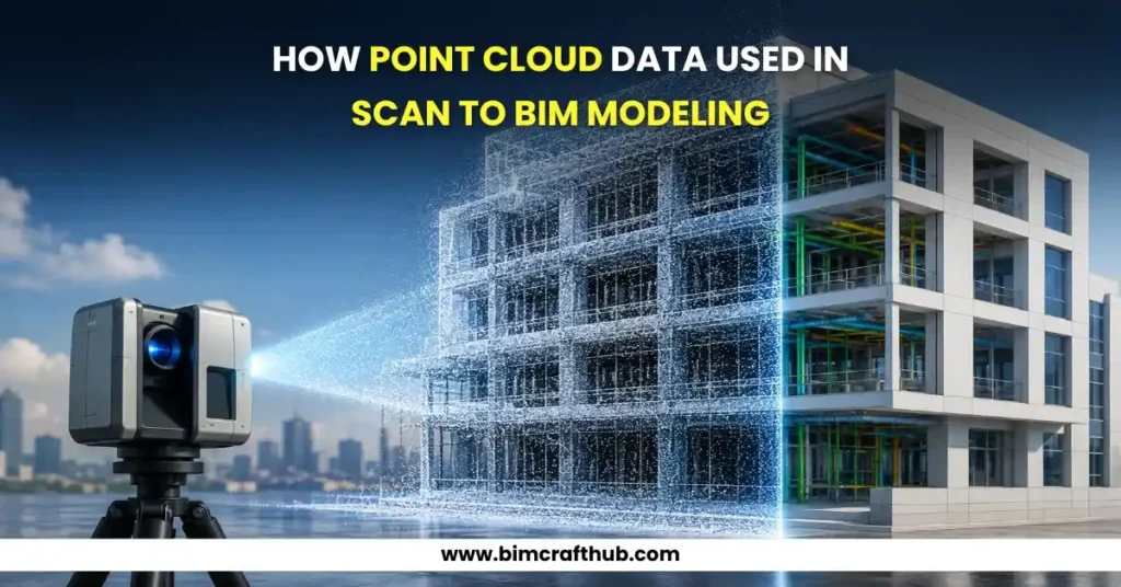
Understanding Point Cloud Data
Think of point cloud data as a dense web of millions of individual spatial coordinates captured via 3D laser scanners. These coordinates trace the true shapes and physical measurements of a property or land plot. Since every single dot holds specific X, Y, and Z spatial positions, they construct an incredibly faithful digital twin of actual field conditions. This ultra-rich data gives project teams a clearer picture of the existing property, dramatically sharpening their planning phases long before site work kicks off.
Laser scanners sweep over every exposed area—mapping walls, overhead zones, floors, pipe runs, ventilation systems, and structural framing. This massive sweep gets compiled into specific files like RCP, RCS, or E57, which can be dropped straight into modeling software to guide intense coordination among various trades and project owners.
What Is Scan to BIM Modeling?
At its core, this method involves translating raw coordinate files into a highly organized 3D model through platforms like Autodesk Revit. Rather than sending out teams to stretch tape measures across old rooms, experts use laser data to compile spot-on digital twins. This approach cuts down on repeated site visits, speeds up plan production, and takes a lot of friction out of the design pipeline.
The resulting model maps out architectural forms, structural columns, and MEP networks based on real-world dimensions. Getting this right helps squash spatial clashes on screen and prevents expensive site blunders. These highly accurate models also give builders a reliable reference point, improving clear communication from day one through handover.
Also read: Difference Between Point Cloud Modeling and Point Cloud to BIM Modeling
How Point Cloud Data Is Captured
The real work begins with the on-site field survey. High-precision laser units scan rooms from various viewpoints, and these individual setups get merged together into a master spatial grid. Modern field scanning tech ensures that tricky architectural geometries and tight spaces are recorded perfectly for the modeling stage.
1. Site Scanning
Surveyors move the scanner to different vantage points to capture every nook and cranny of the building. Today’s hardware can lock down millions of measurements in just a few minutes, making it a lightning-fast alternative to old-school manual field notes and hand measurements.
2. Data Registration
After scanning, all scans are aligned and merged together using specialized software. Stitching these scans together is known as registration. Doing this carefully ensures that the ultimate data files perfectly line up with real-world dimensions, leaving zero gaps or skewed walls in the final layout.
3. Point Cloud Cleaning
Unnecessary data such as moving objects, people, or noise is removed to improve model accuracy. Clean point cloud data helps BIM professionals work more efficiently and produce reliable models with better detail and higher precision for construction planning.
4. Importing into BIM Software
Once cleaned, the point cloud is loaded into a program like Revit. Modeler teams then use this spatial data as an absolute guide to build out smart 3D files that power design coordination and ongoing facility tracking.
How Point Cloud Data Is Captured
Think of the spatial data as a 3D blueprint template. Modelers literally trace over the point cloud data to shape walls, slabs, ceilings, steel framing, doors, windows, and full MEP networks, maximizing file accuracy and driving down design mistakes during building phases.
Accurate Existing Conditions Modeling
Hand measurements frequently suffer from human slip-ups because manual techniques overlook subtle building shifts or sags. Laser data locks down exact current situations, allowing technicians to build highly reliable as-built records that are crucial for historic restorations or additions where missing an inch hurts.
Architectural Modeling
Architectural elements like exterior finishes, window patterns, roofing shapes, and room dividers are drafted directly using the scan data. This keeps the virtual file perfectly faithful to the physical building, aiding visual checks and keeping design teams tightly aligned.
Structural BIM Modeling
Structural bones like main beams, concrete pillars, and floor slabs are mapped out with the scans as a guide. Structural teams use this data for safety evaluations and coordination, which makes it much easier to spot building settling, leans, or old framing flaws.
MEP BIM Modeling
Utilities like mechanical piping, electrical runs, and plumbing lines can also be traced right out of the scan data. Identifying existing equipment layouts and main conduit paths becomes simple, which sharpens routing design and cuts down on unexpected trade interferences during building.
Clash Detection and Coordination
A massive win with this workflow is the major boost in project coordination. Because the digital file models true-to-life field situations, crews can run reliable conflict checks across all trades, stopping delays and over-budget field modifications before they happen.
Also read: Top Benefits of Architectural Modeling for Architects & Developers
Benefits of Using Point Cloud Data in Scan to BIM
Improved Accuracy
Laser capture delivers near-perfect accuracy, wiping away the usual human drafting mistakes. Having such reliable initial data elevates the quality of the model and builds a solid foundation for field logistics.
Faster Project Delivery
Field scanners pull in data incredibly fast, replacing weeks of manual surveying and sketching. This speedy field collection allows the entire modeling team to wrap up their deliverables ahead of schedule.
Better Renovation Planning
Highly precise as-built records let designers map out building retrofits with complete peace of mind, taking the guesswork out of tricky demolition phases and structural additions.
Reduced Construction Errors
Spot-on files smooth over cross-trade tensions and cut down on physical space arguments on site, boosting overall field output and project momentum.
Enhanced Facility Management
Property management teams can take these scan-derived files and use them for maintenance tracking, asset scheduling, and planning future building alterations over the structure’s lifespan.
Industries That Use Scan to BIM Services
Multiple sectors lean on scan-driven workflows today, ranging from architectural design shops and commercial general contractors to industrial plants, hospitals, school campuses, and transit hubs. They use this tech to secure tight accuracy and smooth out operational bottlenecks on complex properties.
Challenges in Point Cloud to BIM Conversion
While the methodology offers clear wins, turning Point cloud to BIM conversion does bring its own hurdles. Processing massive file sizes, dealing with leaning historic structures, and keeping precision high requires deep technical know-how and heavy-duty computers.
Large File Sizes
Laser files are notoriously huge, meaning you need serious workstation power to handle them. Organizing data smartly and refining your computer processing steps are essential to keep large-scale jobs moving without crashes.
Complex Geometry
Historic or warped buildings often demand special drafting finesse, meaning you need seasoned modeling pros on hand to accurately translate unusual shapes or leaning walls into usable geometry.
Skilled BIM Professionals
True accuracy relies completely on expert modelers who understand both field scanning realities and complex drafting software, ensuring the ultimate files contain trustworthy information.
Conclusion
Laser scanning serves as the bedrock for modern documentation by offering a crystal-clear digital blueprint of old structures. Whether you are building architectural paths, tracing structural steel, or mapping complex plumbing lines, this spatial data boosts project precision and cross-team unity, helping managers make smarter choices and dodge site errors long before crews show up.
As commercial developments grow more intricate, the need for trustworthy scan conversions keeps climbing. Companies aiming for smooth, error-free pipelines can win big by tapping into professional conversion workflows that reshape raw laser measurements into smart 3D systems built for easier planning, better communication, and long-term asset management.
Also read: 9 Benefits of Structural BIM Modeling for Construction Projects